S10 Senderos Gran Canaria
Cruz de Tejeda - Las Rosadas - Teror
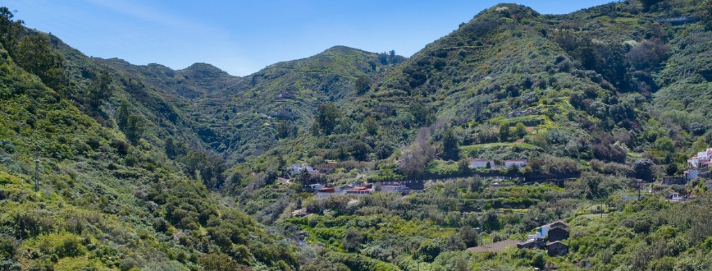
This route starts in Cruz de Tejeda, juncture of highways and roads, apart from being dividing line between the townships of Vega de San Mateo and Tejeda. Because of its strategic position, it is one of the main sites of the center of the island, to make a break and to trade (exchange of goods) and of course, landscape contemplation because it is visible a great part of the Caldera de Tejeda and majestic rock.
Cruz de Tejeda, is accessible by public transport. In addition, there is an Insular Bureau of Tourism and various accommodation facilities and where you can enjoy the rich cuisine of Gran canaria.
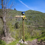
From the parking area (behind the Parador Nacional de Tejeda) there is a choice of two paths. One takes the path towards Artenara "NO", and the other, heading NE, to Teror . There are wooden signs and indicative maps.
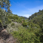
The track ascends for a kilometre approximately, to the road GC-150, The Ravine of Cruz Chica, where you can see yellow gorse, salvias, codesos, etc. Crosses the road and down the ravine of rocks, in the shadow of the Canarian pine trees and a lush understory due to high humidity of the trade winds. This section ends at the confluence of the road GC-21 and GC-230.
In the next subsection we highlight the place known as La Caldereta, which corresponds to several volcanic cones, houses of the 19th century and a irrigation channel of Crespo. After passing through this beautiful area you will reach the road GC-21 (linking with Artenara - Teror) and our next stop will be "lavaderos de Lanzarote", so marked, together with the village of Lanzarote.
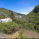
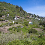
Then we follow a long stretch of asphalt until we arrive at El Lomo y El Patronato (Lomo de las Rosas), both belonging to the to the township of Valleseco. Passed the House marked No. 11 (the last White House en la calle El Lomo de la derecha) it´s very important to pay attention, because we will have to abandon the road for a road that descends to our right. And there before our eyes is the basin of the Madrelagua ravine and with the mountains in front (Valerio mountain, El Talayón and José Manuel mountain). While we observe this scenery we will slowly descend along a narrow track that wades into the ravine of El Chorrito arriving at Los Naranjeros (on some maps: Los Naranjos), where, taking advantage of a small concrete bridge, we cross the bend of the ravine of Madrelagua entering into the town of Teror.
In summary, this route, which takes place in other townships is subdivided into the following sections:
Section 1: Cruz de Tejeda-El Salviar-Degollada de Cruz Chica-Barranquillo de Peñones.
Distance: About 2930 metres. Approximate time: 1 hour.
Section 2: La Solana de La Caldereta - Hoya de Los Manzaneros (Caldereta) - Pozo de la Asomadillas - Lavaderos de Lanzarote.
Distance: About 2260 metres. Approximate time: 30 minutes.
Section 3: Lomo de La Rosa - Barranquillo del Chorrito - Los Naranjeros-Barranco de Madrelagua.
Distance: About 2.420 metres. Approximate time: 35 minutes.
Path in Teror
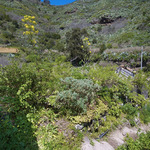
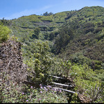
Already in the territory of the Villa Mariana de Teror, our path goes on the right side of the ravine Madrelagua (downstream) to cross between the lush vegetation, formed by remnants of monteverde and typical agricultural crops in the area: millet, potatoes and many fruit trees (orange trees, lemon, pear, plumtress, nispereros, etc..).
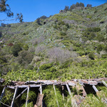
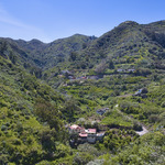
The Madrelagua ravine is a singular beauty. The name already evokes a past full of springs, fountains and plenty of water. Today, in some sections of its long distance, runs water freely. Its runway is a very rugged terrain, which highlights the forest mass of trees, both in the center of the ravine and on both slopes.
Section 1: Barranco de Madrelagua-Casas de la Vuelta-Las Rosadas.
Distance: About 2500 metres. Approximate time: 50 minutes.
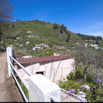
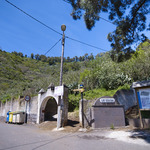
After crossing the ravine over the bridge, we climb between dwellings into a track of asphalt, where we turn left downhill. where the asphalt finishes we are on the"La cueva de Martin", track, which happens to be earth and concrete,this penetrates into the shade of a grove of laurels (Laurus novocanariensis), black poplar (Populus nigra) and white (Populus alba).
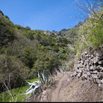
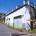
Twenty metres before a curve there is a garage, to our left. It is a slippery slope that forms various tracks with curves and drops sharply, into the bed of the ravine of Madrelagua. After crossing it, we walk in parallel to the crops and then by a well depressed and marked dirt road that leads to the homes of Casas de la Vuelta and, subsequently, the narrow road of asphalt from Las Rosadas.
Section 2: Los Llanos-Town centre of Teror
Distance: 1200 metres. Approximate time: 30 minutes.
Out to the main road (the GC-21, linking Teror, Valleseco and Artenara), we must walk on the right -direction to Teror- about two hundred meters on the tarmac, always paying attention and with the necessary caution.
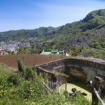
Soon we arrived at the entrance, on the right, of the road "Lugar Cuesta de los Estanques", a concrete path that descends sharply to Los Llanos and empties into the street of "El Quebradero". We turn left, always in a straight line, crossing to the street "Isla de Gran Canaria", where we continue until its end and connecting with the main road. We must now walk 100 metres on the left (with caution) and out right on the cement down to the homes of Buenavista and stairs that allow us to cross the last asphalt road, entering Teror next to the playground of the Fuente de La Higuera, rear of the basilica.